Delft:
The City Where We Are
A small city with an outsized history — and an urban future still being negotiated.
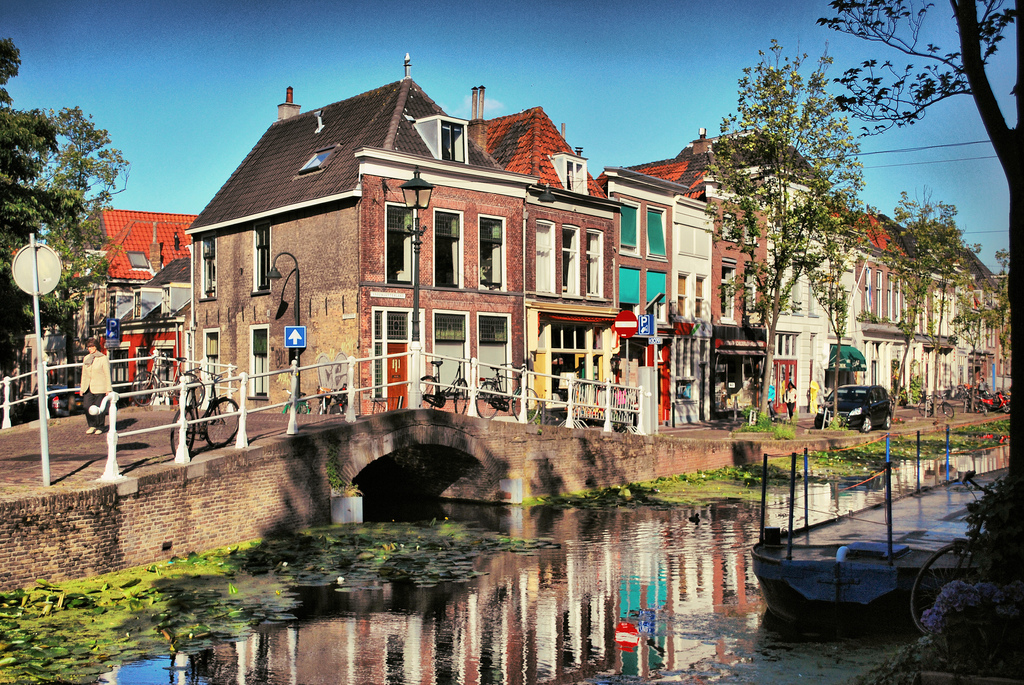
Delft is compact, navigable, and rich in contradictions. It is a canal city that flooded repeatedly until it learned to govern water; a trading city whose merchants sponsored revolutionary science; a royal burial ground and a university town; a place that produced two of the seventeenth century’s greatest minds and is now grappling, like much of the Netherlands, with a housing crisis that its elegant historic core does little to resolve. For participants in the Summer School, Delft is not merely a backdrop: it is a living laboratory in which the tensions between heritage and growth, between the market and the right to the city, between municipal ambition and community displacement, are being played out in real time.
Three Figures Who Changed How We Think About the World
Vermeer spent almost his entire life within a few hundred metres of the Markt. His painting View of Delft (c.1660–61) — one of the most studied urban landscapes in the history of art — depicts the southern waterfront from across the Kolk with a precision that has allowed historians to reconstruct the city’s appearance at that moment almost brick by brick. His interiors record the domestic spaces of the seventeenth-century Dutch bourgeoisie with an attention to light and materiality that remains unmatched. He died in debt, leaving a wife, eleven children, and a small number of canvases that were not widely celebrated until two centuries after his death.
Van Leeuwenhoek was a draper and municipal official who taught himself to grind lenses of unprecedented quality and used them to become the first person to observe bacteria, protozoa, and the circulation of blood through capillaries. He reported his findings in letters to the Royal Society in London, in Dutch — a language the Society could not read — and was eventually elected a Fellow. His observations demolished the theory of spontaneous generation and founded modern microbiology. He worked entirely outside any university and had no academic training. He and Vermeer were born in the same year, probably knew each other, and are buried metres apart in the Oude Kerk.
Hugo de Groot — Grotius — was born in Delft and is widely considered the founding theorist of modern international law and of the doctrine of natural rights. His Mare Liberum (1609) argued that the sea could not be owned by any sovereign power, providing the legal basis for freedom of navigation. His De Jure Belli ac Pacis (1625), written in exile after he escaped a life sentence in Loevestein Castle concealed in a book chest, established the framework of just war theory and the inviolability of certain rights regardless of sovereign will. For a course concerned with spatial justice and the right to the city, Grotius is more than a historical curio: he is the intellectual ancestor of the tradition in which we work.
Four Things Worth Knowing About Delft
A City in the Randstad
Delft sits in the southern Randstad, the dense, polycentric metropolitan region that also contains Amsterdam, Rotterdam, The Hague, and Utrecht. The Randstad is home to roughly 8.5 million people — more than half the Dutch population — and is one of the most intensively urbanised areas in Europe. Delft’s own population of approximately 103,000 is relatively small, but its spatial position between Rotterdam (13 minutes by train) and The Hague (13 minutes by train) makes it part of a continuous urban fabric with no clear metropolitan boundary.
For planning students, this geography raises immediate questions. Where does Delft end and the Rotterdam metropolitan region begin? Who governs the infrastructure, the housing allocation, and the green spaces between them? The Netherlands operates a strong tradition of spatial planning at the national and provincial levels, but the governance of the Randstad as a functional urban region has been a persistent institutional challenge, with responsibilities divided between municipalities, provinces, and national ministries in ways that frequently produce coordination failures.
Spatial justice angle: The Randstad’s housing shortage is not distributed evenly. Lower-income households are concentrated in the outer rings of Rotterdam and The Hague while Delft’s historic centre, with its premium rental market and tourist economy, exercises a powerful displacement pressure on long-term residents and students alike.
Built on Water: History and Urban Form
The name “Delft” derives from delf, the old Dutch verb meaning to dig — a reference to the canal that was excavated to drain the peat lands on which the city was built. The Oude Delft, the oldest surviving canal, runs the length of the historic core and dates to the twelfth century. The canal system was not merely a transport and drainage network: it was the organisational spine of the city, shaping plot boundaries, street alignments, and the grain of the urban fabric in ways that remain legible today.
Managing water was always a condition of urban existence here. The city sits at approximately sea level, and the surrounding polder landscape is below it. The regional water board — the Hoogheemraadschap van Delfland, established in the thirteenth century and one of the oldest democratic institutions in the world — has governed water management in this area for more than seven hundred years, making visible a form of collective governance that long pre-dates the Dutch state.
On 12 October 1654, a gunpowder magazine at the north of the city exploded with catastrophic force. The Delftse Donderslag — the Delft Thunderclap — destroyed a third of the city, killed more than a hundred people, and buried the painter Carel Fabritius, Vermeer’s teacher, under the rubble of his studio. The reconstruction that followed shaped much of what is now considered the historic core: the city was rebuilt quickly and uniformly in brick, producing a coherent seventeenth-century townscape that has been carefully preserved, and whose preservation today constrains the supply of affordable housing.
Science, Innovation and TU Delft
Delft University of Technology — TU Delft — was founded in 1842 as a Royal Academy for engineers and has grown into one of Europe’s leading technical universities, with approximately 27,000 students, of whom around 25% are international. The university’s faculties of Civil Engineering and Architecture, Urbanism and Building Sciences are among the most internationally networked in the field, and the Department of Urbanism — which runs this Summer School — has a long tradition of critical engagement with planning theory, housing, and the social dimensions of spatial design.
The university’s campus lies to the south of the historic centre, separated from it by a canal and a railway line. This physical separation is now being bridged by the Schieoevers redevelopment, which occupies a strip of former industrial land between the city centre and the campus. Schieoevers Noord is planned to accommodate up to 7,500 new housing units — one of the largest urban densification projects in the Netherlands — along with mixed uses oriented towards the creative and knowledge economy. The redevelopment is explicitly designed to strengthen the link between city and university, but it has also generated significant conflict with the existing communities of small-scale manufacturers, artisans, and creative businesses that have occupied the area for decades and face displacement as land values rise ahead of construction.
For Summer School participants: Schieoevers has in recent years served as a case study area for the Summer School precisely because it concentrates so many of the tensions the course addresses: housing supply against community displacement, large-scale planning ambition against incremental local economy, municipal authority against civic resistance.
Contemporary Delft: Housing, Affordability, and Urban Change
The Netherlands faces one of the most acute housing shortages in Western Europe. A 2023 assessment put the national deficit at approximately 410,000 dwellings, with demand concentrated in the Randstad cities and university towns. Delft is both a beneficiary and a victim of this pressure: a beneficiary because it attracts investment and high-spending residents; a victim because rents for mid-market and affordable housing have risen sharply, pushing out lower-income households and making it increasingly difficult for students, young professionals, and essential workers to find accommodation near the city centre.
The Dutch government has attempted to respond through the Wet Betaalbare Huur (Affordable Rent Act), which came into force in July 2024 and extended rent regulation to a significant portion of the private rental sector for the first time. The policy aimed to cap rents for homes that score below a certain threshold on the Dutch points-based system (the WWS). The consequences have been contested: some landlords have raised rents on properties just above the threshold, others have sold rental properties to owner-occupiers, and housing associations report increased waiting lists as regulated supply contracts. Whether the Act represents a meaningful redistribution of housing access or a well-intentioned intervention with unintended consequences is precisely the kind of empirical and political question that planning students need to be able to analyse.
Delft’s historic centre further complicates the picture. Heritage constraints limit the conversion and densification of existing buildings. The canal-front properties that appear on every postcard are largely beyond the reach of social or affordable housing policy. New supply is therefore concentrated on former industrial sites — above all Schieoevers — or in suburban extensions that are spatially and socially disconnected from the amenities and networks that make central-city locations desirable. The result is a spatial distribution of housing access that maps, with uncomfortable precision, onto income.

Johannes Vermeer, View of Delft, c.1660–61. Oil on canvas, 96.5 × 115.7 cm. Mauritshuis, The Hague. Public domain.
The Most Studied Urban Landscape in the History of Art
View of Delft was painted from the upper floor of a house on the south bank of the Kolk inlet, looking north across the water to the city’s outer walls and towers. The Schiedam Gate is visible to the left; the Rotterdam Gate and the Nieuwe Kerk tower to the right. Scholars have used the painting’s precise rendering of morning light — the shadows, the reflections, the cumulus clouds — to determine that Vermeer was depicting the city as it appeared between 7 and 8 in the morning on a day in early September.
Marcel Proust called it the most beautiful painting in the world. For historians of urbanism, it is something else: a documentary record of a seventeenth-century Dutch city at the peak of its commercial power, painted by a man who rarely travelled more than a few hundred metres from where he was born.
The original hangs in the Mauritshuis in The Hague, thirteen minutes away by train. If you have a free afternoon, go.


Find Your Way Around